Walk 4 Faversham to Sittingbourne (Kent)
Map: L/R 178
Distance: 12 miles approx
Difficulty: quite easy but can be windy and cold at times
Terrain: quite easy, mostly earth/grassed paths and pavement
Access: parking at both ends
Public transport: train links between the two towns
Public transport: train links between the two towns
Leaving Faversham carry on up the east side of Faversham Creek along the Saxon Shore Way.
Although marshy and sometimes bleak, the often lonely walk has its own quiet atmosphere. The views are renowned for their variation in light.
Although marshy and sometimes bleak, the often lonely walk has its own quiet atmosphere. The views are renowned for their variation in light.
As you turn westwards along the River Swale you will see a hide for keen birdwatchers. The nearby Oare Marshes are part of a nature reserve supporting a wide range of wetland birdlife.
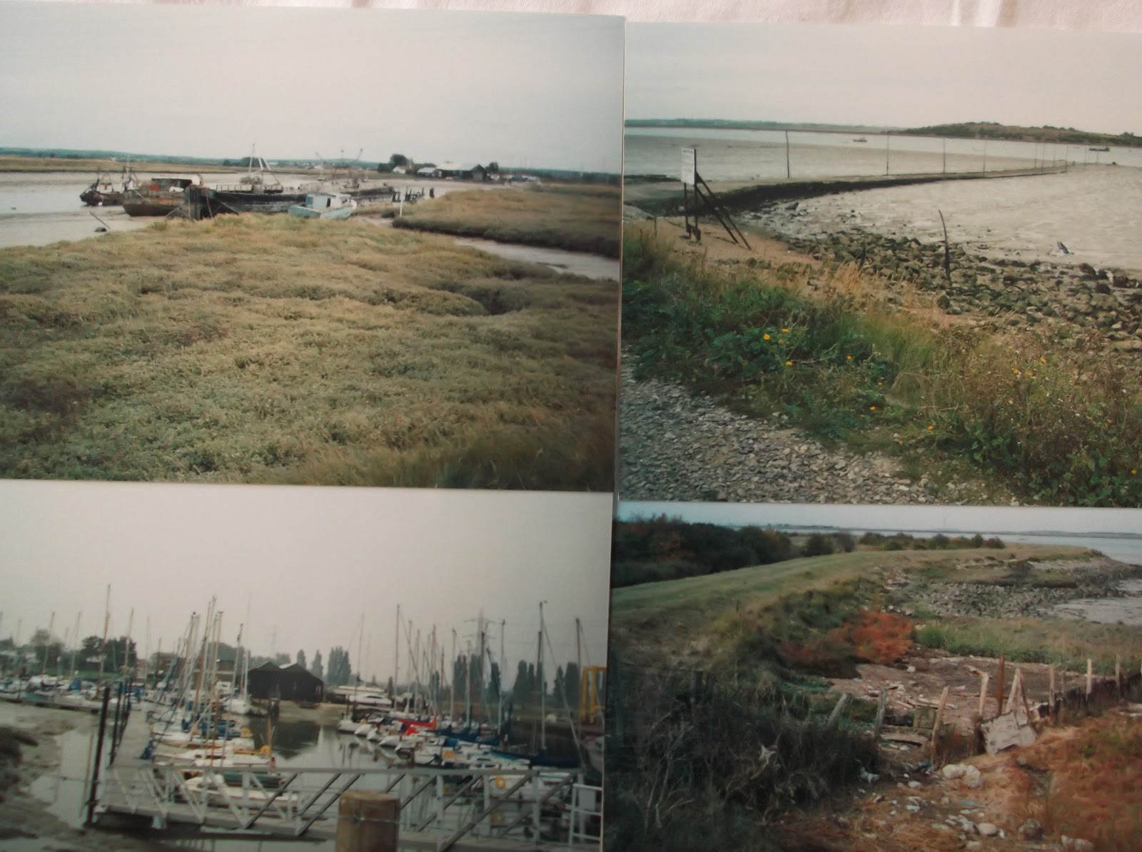
Soon you will come across the old Harty Ferry landing. This used to link the shore with the Isle of Harty (which is part of the Isle of Sheppey) on the opposite bank. If the weather was calm the ferry was rowed across and had to cope with the treacherous currents in the Swale. There is a record of a ferryman having been drowned in the 1800s. The ferry men had a monopoly and were reportedly sullen, sometimes asking the passengers to help out! The ferry was last used in 1946 having been made redundant by the building of bridges. A bascule bridge (meaning part of it can be raised using weights) at Kingsferry was followed in 1960 by a reinforced concrete bridge, then a further bridge was built recently.
Walking past Teynham Level and the marshes inland,
Soon the path sweeps inland to the
Opposite the Saxon Shore Way is Elmley Island
Some wrecks can be seen (not just boats, a car was poking out of the water when I walked it) especially at lower tides. At an area called The Lilies the two bridges to the Isle of Sheppey can be observed. The older one is lifted every day to let shipping through. Kemsley paper mill was still open and could be seen on the opposite bank when I walked this stretch. A 2’6” gauge steam railway (Sittingbourne – Kemsley) is/was on the other bank. It was open to the public but was closed when the mill land was sold. I understand it is due to reopen in 2011 when viaduct repairs have been completed. (Update - it reopened to the public in May 2011 and is a popular attraction).
The walk finishes with a walk down
Snaps show: rusty hulks at Faversham Creek; the old Harty Ferry point; boats at Coyner Creek; the end of the path at Coyner Creek.
No comments:
Post a Comment